Episode Transcript
[00:00:00] Speaker A: This episode, we're going to talk about horseshoe weather. What the heck am I talking about? Well, I don't really know, but when I look at a map, a moisture map, it looks like a giant horseshoe across the Canadian prairies. So let's get into it with Brett Waltz, episode 128 coming at you right now.
Hey, folks, welcome to the what the Futures podcast, your quick guide to better farming decisions.
All right, folks, welcome into episode 128 of the what the Futures podcast. And my name is Ryan and I'm the host here over at what the Futures. I hope you're having a wonderful Positive Friday. This is.
Well, this is episode two for you on Positive Friday, of course, recorded each and every week in the UPL studio.
And you're out there, you're getting it done.
You're doing the best you can in these current spray conditions. It's challenging out there. You're getting the acres knocked off. Don't forget, though, about a great product called Wave. It's a biostimulant product from UPL, something our farm used in 2025 on the canola crop. Noticeable differences on where we applied Wave and where we didn't.
And this year we're excited to try it on our piece.
Peas is the.
I don't know if it's the most exciting one. You know a crop when you're looking at Wave, if that, but it does. It seems to be. It's got a little, you know, when you talk about it with the UPL rep, they have a little sparkle in their eye. So Wave and peace go work. Well, hand in hand. And of course, you can use it on Canola, which we will be on our farm as well here in 2026. If you are enjoying the content, why don't you do me a favor? I'm trying to hit 1500 subscribers. So go check out the YouTube channel. If you're not into YouTube, you're like, no, Ryan, I want to read instead. Then just go over to ryandeni Ca and you can sign up on the email list. I send out a fun little email Friday mornings. It's your little guide to crop marketing. It also highlights some past episodes. So go give that a follow, why don't you? Positive moments for the week. Well, I need to.
I need to. I'm going to pull up real quick here, guys. Of course, we're continuing our series of shorter episodes.
It's not that we get many complaints. You know, I get called out every once in a while and say, oh, dude, you were Way out to lunch on this one or you got this wrong in the markets, like that's natural. You're gonna get that. But I also received a couple of nice emails here lately. Martin sent in, Martin, this is Saskatchewan number, but Martin says I wanted to.
Well, he signed up for the futures text updates number one. You guys, if you're listening to the end of the show, you know what I'm talking about. Martin says, I just want to add how awesome your show is. I don't think I have missed a single one since you started.
Which means if Martin is listening, that means the first 20 episodes, camera to the sky in the garage. You were there. You were there for those first moments. So thank you, Martin. I do appreciate it. He goes on to say, I really like the wide variety of things you cover for farms. Really makes people think outside of the box from buying farm inputs to marketing. So, Martin, thanks for the email.
And that's why this show was created. That's why I started this thing, was to kind of provide some transparency on how I see things and, you know, try to, I don't know, help. Sounds kind of corny, but try to help where I, you know, where I can. And so hopefully that resonates and is coming across. So thanks for that. I also got another one here from Jordan and Jordan says, I appreciate what you offer in your podcast.
Since listening, I have set up an account with Simple Hedge. I got going with Quinton at jgl and I now get quotes from Laura Lee from Fuel Nexus. All things that I believe will help with our farm's bottom line. Looking forward to the conference. And Brandon, keep doing what you're doing. Well, again, Jordan, thank you very much. Positive moments this.
Those two guys writing some emails to me and just really pumping my tires. I might even be blushing here a little bit as I record this because, you know, the praise is and comments is appreciated. Thanks for sending those in. You helped fuel the episodes here a little bit for this week, so I do appreciate that. All right, folks. Well, we have Brett Waltz with BAM Weather that's going to join us here just to give us a little bit of a forecast, an early summer forecast, what to expect for the next couple of weeks of June, and also what could we start seeing here in July and August? You know, weather obviously always plays a big part in growing a crop. We have some wonky weather this year. We have an El Nino. Brett's going to talk about that. The implications that could be coming for the prairies and for the US later this year, later this Summer and how we can kind of manage around that. It's been a year of extremes already. Does that continue to what degree? We're going to find out in just a moment. This video as well, just in case you're, you're wondering. Lunchbox Crew guys saw this earlier in the week. We do these webinar style calls and Lunchbox Crew members participate in the calls, ask questions and you'll see that, you'll see that throughout the recording. I pull up a few names and some questions get asked. So I wanted to give you just a little bit of a sneak, you know, like a sneak peek, like a behind the curtains kind of thing. Thing. People ask. What is the Lunchbox Crew? It's my spin on crop marketing, but it's, it's more than that. It's a community. Farmers, you know, talking to each other this week, the spray, how to set a certain sprayer up, how to set up a certain monitor, tips and tricks on, on, you know, spraying and all sorts of conditions. That was a hot topic here in the Lunchbox Crew. So it is very much a community. I throw in, you know, articles, writings, short things about what's impacting markets, you know. You know, I've been highlighting the canola chart and how it keeps back testing this trend line on this market decline tossing strategies in there. And then I also put up my hand and say, hey guys, I think you should sell some barley. This is why. I think you should sell some lentils, you know, this is why. And so this is just a little bit of a sneak behind that. So I hope you enjoy this one. Again, keeping it short and sweet for you here. Double episode Friday 1st. It's a first for us, I think. Hey, double episode on pause of Friday. There we go. Anyways, let's get into it. Brett Waltz with BAM weather.
Well, Bret, we've got a couple people joining here.
So you're, you're in, in for a severe, you know, weather event in your backyard today. I guess you're experiencing it right now.
Is this, has this been anticipated like this, the storm system so far? Is this a quiet time or quieter than expected or is it more active or somewhere in the middle?
[00:07:04] Speaker B: I would say for us it's especially north of us a little bit more active. And there's a couple of reasons for that. And I'll go into it from a Canadian perspective as well. But the El Nino that we've been talking about has trended exceptionally strong, very fast over the past couple of, couple of weeks.
Not only from an ocean standpoint from an atmospheric standpoint. And in my opinion it is. Has kind of shifted the entire pattern a little bit further east.
We thought that the plains might be the more active spot from a severe weather standpoint, but the jet stream is so strong related to the El Nino, it's just shifted over into our neck of the woods. And this, this system that's moving through right now for us in the Midwest is the. Going to be the record strongest low pressure system for this time of the year in this part of the country. So very, very unusual to get something like this this time of the year.
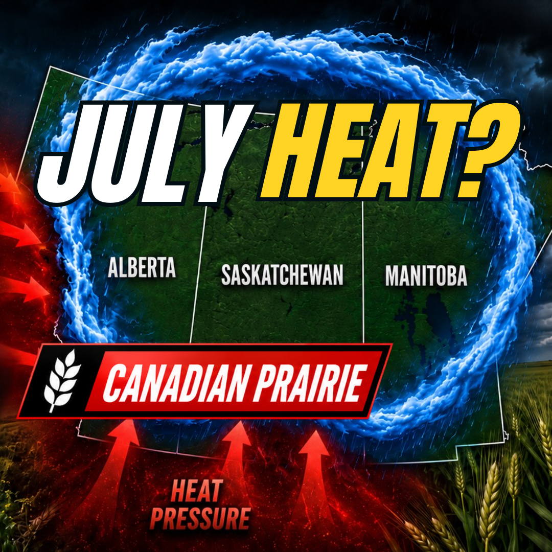
[00:08:02] Speaker A: Okay, fair enough. Okay, well it looks like we've got a. Yeah. Half dozen or so folks that have joined. Everyone's busy spraying right now. So maybe you can shed some light on our window for spraying here the next few weeks. But I'll turn it over to you, Brett. Thanks for joining us here once again and providing us a little bit of perspective here as we, as we go through the next few weeks and circle back at the end with a couple of comments about this horseshoe weather pattern we have. I don't know what you guys call it, but it looks like a horseshoe to me on the map. So take it away.
[00:08:35] Speaker B: Yes, the. I believe the Omega block is what us meteorologists refer to it as. That was a big deal early in June especially. And I think part of the reason the weather has gotten so active in the United States is because we're starting to push that out. And as we push that out, things start to get more active. So taking a look here at the last 30 days of observations, it's been warm, it's been warmer than normal for much of the Canadian prairies. There have been some spots that have averaged out a little bit more seasonable. A couple of blobs here and there, slightly cooler. Some of that may be feedback from some of the snow that you all had very late in the season.
But the pattern, and I think we had talked about it last time, finally started to warm up a bit, especially in the early portion of June.
We had some well above normal temperatures set up across the southern Canadian prairies and the north central part of the United States. Ultimately that is related to that Omega block pattern or the horseshoe pattern. I like that. I may have to. I may have to start using that. Being from the southern Indiana, northern Kentucky area.
Horseshoes and horses are a big deal down there. So I may have to start using that. But that ultimately the culprit of the very warm pattern. But we do see a change coming at least for A time. I wouldn't say that this is a long duration change, but for the Canadian prairies it's going to go back to a cooler than normal pattern over the next seven days.
Pretty cool. The further east that you go into parts of Manitoba, I wouldn't say crazy unusual. You're looking out towards Saskatoon and Edmonton and Calgary, a couple of degrees cooler than normal, but certainly not well above normal like we had at times early on in June. And down into the US Ag Belt. You can kind of see the northern portion of it on these maps. Pretty consistently cooler than normal as we head over the next two weeks, the last two weeks of June. But I do think the prairies are in a spot that the pattern can warm back up.
I don't think it's a substantial heat. I really don't see that. I think if that is going to set up, it's more so into the western half of the United States and into perhaps the Pacific Northwest. But for the prairies, a couple of degrees warmer than normal. All things considered, not too bad for this time of the year. I would say we're not going back into that Omega block type of a pattern that I can see right now.
The blocking high is actually getting kind of trapped well north in Canada, closer to the Arctic Circle. And that is going to make it a little bit more difficult to get notable heat waves into the northern US and Canada over the next few weeks.
However, with this transition, I do think that the pattern is going to get more active again, especially for the western Canadian prairies. And so the next seven days some decent moisture across portions of Saskatchewan and even into western Manitoba as well.
I think that we've got a pretty widespread corridor of above normal rains the next seven days.
And then if we look at the last week of June, I wouldn't say it's soaked, but I would say adequate rains for the vast majority. Maybe the far southern portions of the prairies south of Saskatoon and Calgary ultimately average out slightly drier than normal or near normal. But certainly from a drought perspective, I don't see anything overly concerning right now.
I think that perhaps maybe the far south eastern Canadian prairies north of the Minnesota and northeastern North Dakota border may average out a bit drier the next two weeks. The next seven days you're kind of in the far southeastern portion of where the better rains are going to set up. But all in all, pretty decent forecast from a rain perspective. Now if you're wanting to get out and spray and or you need to cut hay or whatever the case may Be maybe a little bit more challenging to find extended dry time over the next two weeks.
[00:12:44] Speaker A: Okay.
[00:12:45] Speaker B: As we roll this forward, I do expect that some of that can start to back off a little bit as we head into the first two weeks of July. The pattern I would say leaning slightly warmer than normal, but again, I wouldn't favor excessive heat. Can you get a couple of days here and there that are a bit hotter? Sure. But I wouldn't say anything unusual for summer.
And then from a rainfall perspective, I do think that the southern prairies can run a bit drier than normal the further north and west, that you go a little bit wetter than normal. But I again wouldn't favor substantial dryness. I think even in the below normal rainfall areas, there's still timely rains. You're still going to have some moisture. It's not going to be bone dry in my opinion. And for the areas that have rainfall, it's probably not going to necessarily be excessive. I think where that could end up being is down in southern portions of the U.S. ag belt, in parts of Missouri, Oklahoma and the lower Ohio Valley. A lot of the areas that are getting hit right now with the severe weather continuing to move along. I do want to get a little bit more into the back half of July and I want to get into just the rest of the season as a whole, next six weeks and maybe even a little bit beyond that as we head into the month of August. August. I wanted to give an update on where we are at with El Nino, because that's the big story, right. Everybody's talking about El Nino. How is that going to influence the pattern? We alluded to it at the very beginning of the stream here. That the El Nino would has ultimately been kind of shifting things even a little bit more extreme than we expected.
We're trending towards one of the strongest El Ninos, if not the strongest El Nino on record right now, where we're going to be rivaling years like 2015 and 1997.
And we're seeing the El Nino set up. It's officially a weak El Nino right now. It's very rare to have an official El Nino by this point in the season.
And the ocean waters off the west coast of South America are Now more than 2 degrees Celsius above normal. That is a very, very strong precursor for a super El Nino that we are seeing develop. And if we look at the latest forecast, to be honest, the model forecasts right now are completely bonkers.
This model is a multi model ensemble. So it basically is looking at every different weather model on the planet. And Its mean is 3 degrees Celsius above normal for the Enzo regions, 3 degrees Celsius in terms of the ocean waters above normal, that would shatter the record. In terms of El Nino, I suspect it's a little bit too aggressive. But the bottom line is we're rivaling the strongest El Nino events on record, and that ultimately is going to be the number one pattern driver ahead. But there are some trends in other parts of the world that I think will have an influence ahead as well. If we start out with the Enzo evolution in El Nino, our top four strongest years back to 1980 are 1982, 1997, 2015 and 2023.
And the theme here, I would say, is a lack of substantial and sustained heat, especially south.
And from a moisture perspective, maybe the further north and east you go slightly drier, But I would say a lot of areas here from an El Nino perspective, it would favor a more active pattern.
And ultimately, I don't see a major red flag here from a dryness or a drought perspective based off of these maps. Again, maybe far northern portions of the prairies from this analog alone. But there's some other things that I want to look at, and that's the Pacific Ocean. We talked about this last time. The very, very warm ocean waters off the southwest coast of North America. That enhances our jet stream and, and arguably that's even a cooler risk and a wetter risk overall. And so again, not seeing any major red flags from a crop perspective, certainly from a drought perspective, at least with this analog set.
However, I would argue from what I'm seeing in the overall pattern in North America right now, the Atlantic Ocean may actually be having an even bigger influence on the pattern. In the Pacific. We kind of had this last year. It's pretty similar to last year, very similar to 2015, if there's an analog year that you want to go back in your record books and look at as a comparison to this year, in my opinion, it's 2015. Right now, the pattern is very, very similar to that year overall. And I think not just in the short term, but months down the road, that is the top running analog, and it's very good with the ocean State.
And this does present a little bit of a hotter and a drier risk. Now, further south, where there has been some dryness leading into the season, it's still wetter than normal.
And I would still argue that with this setup, even the drier than normal areas are going to see some timely rains. It's not completely void of moisture. But in the far northern areas this would be a drier risk to the forecast. This is still only 1 to 2 degrees warmer than normal for temperature. So it's a bit hotter, but it's not substantial, but certainly a bit drier on this analog than the other two. That being said, it's the blend of everything that matters the most. You have to blend all of these different ideas together. It's not just El Nino, it's not just the Pacific, it's not just the Atlantic, it's the mix of them. And As I mentioned, 2015 I think is the top dog overall for July. It would favor a slightly warmer than normal pattern. It's not extreme, but it's slightly warmer than normal. And it would favor slightly drier than normal conditions north, slightly wetter than normal conditions south, but still timely rains in here. This is still not a bone dry pattern across the board. Could we dry out a little bit at times? It's possible, but it's not a bone dry pattern in the slightest, in my opinion. Now we roll that into August and we can really start to see maybe that El Nino influence show up a little bit more. And the August analogs are near normal for temperatures and for the most part seasonable to wetter than normal from a precipitation standpoint. And so long term, even if that slightly drier risk were to happen to pan out for July, long term conditions look pretty good from a drought perspective in the extended range.
And with that in mind, we'll look at our outlooks and I am going to lean slightly warmer than normal, slightly drier than normal. But I really, really want to emphasize I don't think it's bone dry. I think that there are timely rains, there are probably going to be active periods, but there are also a couple of periods that can lean a bit drier from a temperature perspective. Not looking at extreme heat, but a couple of degrees warmer than normal. I think certainly possible as we roll that into August, leaning slightly cooler, especially south. And I think August has the potential to be more active. El Nino continues to develop full fledged and I think a more widespread wetter than normal pattern with a very strong subtropical and Pacific jet stream is likely.
And so that should really limit long term concerns about any kind of drought in my opinion, not just for the prairies, but for for portions of the US as well that have been dealing with some drier conditions in the western plains.
And so I think the bottom line here, Ryan, is that I don't have like exceptionally strong red Flags right now.
It's not super cold.
There can be some colder periods, but it's not super cold. It's not super hot and dry.
It's rather favorable. And if you go back and look at El Nino's historically, not just for the prairies, but for the US they tend to be somewhat favorable for crop conditions. And from what I see right now, I think that that will be the case moving ahead.
[00:20:51] Speaker A: So, Brad, I would say, and I don't want to put everyone in the same basket because it's such a big area, but, you know, it's been a little bit cooler here lately, and it's been certainly some areas have received extreme precipitation events.
Is that, do you think that's changing as we get into July, then? Like, there's going to be people listening to this that have had more rain in the last couple of weeks than they had in the last, like, three years, four years combined.
[00:21:22] Speaker B: Sure.
[00:21:23] Speaker A: Like, is that the setup for the rest of the summer for these folks, or do you think there's a, there's a change here?
[00:21:29] Speaker B: Yeah, I think that's a fantastic point. So with this setup, in my opinion, what can happen? You can get big storm systems that produce decent amounts of rain, if not heavy rain, and then you can get drier stretches, and so you average out somewhere in the middle. Right. And with those drier stretches, especially north, you know, I think that there are some areas in July that can average out a bit drier than normal. I think that what can happen is you get windows where you get a lot of rain, and then you're pretty dry and you have some of that back and forth with El Nino, I think that storm systems, and we're seeing it here in the US can pack a punch. They just may not be super consistent until we get into August. But I think that extremes one way or the other are certainly a risk. When you, when you talk about the setup that we are at right now, averaging it all out when you finish things up, may end up in a decent spot, but you might have some impactful weather systems that move through, and you might have some periods that are rather dry.
[00:22:34] Speaker A: So we, we have kind of cooler, cooler temperatures, precipitation events, you know, to finish off June. I think most people listening would appreciate a little warmer, drier July just to kind of keep moving things along. And I'm not sure everyone's going to like seeing, you know, moisture in August to a point. Right. Like our crops a little bit delayed. So the talk right now is that, you know, we're going to get quote unquote smoked by a big heat event in July with our later crops.
You know, it certainly doesn't seem to be the theme right now that you're. You're presenting, which makes me feel a little better. Yeah, warmer. A little bit warmer is okay. It's that those extreme events and I think most would welcome this. I will be curious to see what happens in August, how that setup looks and at some point we'll want the tap to turn off so we can finish these crops off and get harvesting.
[00:23:26] Speaker B: Sure, Sure.
I will say looking. I started to do a little bit of research into September. It does look like September could lean a bit warmer overall as we head into harvest. Sometimes that can bring rains up where you all are at in the northern portion of the agricultural belt in North America. But.
[00:23:45] Speaker A: Mm.
[00:23:45] Speaker B: I do think that there's some potential that September could offer up some, some late season warmer temperatures to finish things off. August is interesting because August El Ninos just historically tend to run cooler and active.
[00:24:01] Speaker A: Okay.
[00:24:02] Speaker B: And so as I mentioned from a drought perspective, that's great. But if you need some of the late late season GDU's, if you will, for, for the crop, then it may not be perfect.
[00:24:15] Speaker A: What about, you know, just looking at the US Again here? You know, the way that I look at it is, is pretty. A pretty decent setup for growing a crop. Like, yes, there's extremes, but sure. Is that comment completely off base or do you. Are the ingredients there to. To grow a crop in July?
[00:24:34] Speaker B: I would agree. I think the ingredients are there.
I think the concern at times might be severe weather. Right. Like you get some of these storm clusters and the later you get into the season you get these storm clusters and they can cause crop damage. There's no doubt about that.
[00:24:49] Speaker A: Yeah.
[00:24:50] Speaker B: But from an overall moisture and temperature standpoint, where we've been, where we're going, I would say things look pretty good. You know, there's definitely some spots given some of some of these storm systems and how they get a little messy, they can produce extremes, but someone down the street can get 6 inches of rain and then somebody the other side of the block can get skipped out. There's probably some localized pockets with this type of a pattern that end up not perfect, but certainly compared to some of the La Nina years we've had as of late, I would say pretty good shape. We looked at some top analogs for the US from a corn yield and soybean yield perspective and generally they're near or even slightly above trend line this year.
[00:25:35] Speaker A: Okay.
All right. Well Brett, I, I certainly appreciate you getting us up to speed here on on the latest and greatest from a weather outlook. Yeah. Any other last comments? I think you've covered it all very well today, but anything else kind of stand out?
[00:25:53] Speaker B: No, I, I think that the biggest thing to watch in July and if there's maybe a risk one way or the other, if there's going to be a trend for the prairies, I do think it would be more so on the cooler and the wetter side compared to the hotter and the drier side. The blocking that we're seeing right now in the Arctic, I just don't see it being likely to see sustained heat. Yeah, you can get some short term heat here and there, but sustained big heat waves more common in La Nina years and I just don't have a major concern for that as things stand right now.
[00:26:28] Speaker A: Okay, fair enough. I did get one question that came across here from Chris. So Chris farms when you're looking at a map, Alberta in the very top northwest corner way up there even on this view, the very far northwest he's asking specifically for up in we call it the Peace region. If there's with El Nino any different weather that they could be experiencing from the moisture perspective they've been a little drier on the west side and then getting wetter towards the east and then that horseshoe.
Yeah the, I guess that east side's getting that moisture but the west maybe isn't as much. So I don't know if you can drill down into that region or if you want me Brett to ask you that question on the Clarity chat and then I can circulate that to the group after doesn't matter to me.
[00:27:19] Speaker B: My initial gut there would be the further north and west you go. I think that if there's going to be above normal temperatures and some dryness, that's probably where it would be. That's pretty far northwest. I think I mentioned the Pacific Northwest being a bit hotter and drier overall. So if at times you get some of that high pressure and the ridging of what we call it in that Omega block to try to move north, it would be the that far northwestern quadrant that especially late in the season can happen in El Nino years. You look at, you know, November, December, January, even late late harvest and into winter, that can be a pretty common theme there and you can start to get bouts of that in the summer. So if there is going to be an area that maybe has some bouts of heat, it would probably be up in that corridor all right, well, I
[00:28:14] Speaker A: appreciate you dialing that in for us, Brett. Look forward to doing this again in a month's time. And yeah, stay safe. I know you guys are in for it here today with some, some very intense weather. So stay safe and keep up the good work.
[00:28:28] Speaker B: Thank you. Appreciate it. Thanks for having me on and looking forward to chatting again. Next time,
[00:28:36] Speaker A: I'm not going to do eating your veggies because I did it in the first episode today. So if you're looking for some eating your veggies, just go check out the fertilizer discussion with Linville. All right, Josh. Linville saying, hey, something stinks here in these first prices for summer fill urea, they should be a little bit lower. So go and check that out. We recorded that here earlier today and you can find that wherever you get your podcast or on YouTube. Now if you're liking this, you know the shorter episodes. Again, this is video two.
What did I say? Six, right? Because I'm doing three. I'm going tomorrow to do three. That's going to be about cows. Fingers crossed. Number four is going to be about.
Actually, it's a crop marketing update from me that. Sorry, that's the next one. Crop marketing update for me is coming out next. After that is going to be an update on making a plan on buying fuel. How do you plan your fuel purchase decisions in the year? That'll be the one after that. Then we're going to talk about cows. And then from there, I've got one more. I think it's the. It's the kickoff to the crop marketing Make Cool conference. Yeah. So there you go, guys. Six shorter videos, all in the span of less than.
No, right around two weeks, actually. Yeah, it is two weeks because I'm taking some holidays. So if you're enjoying these, let me know. Ryanothefutures podcast CA don't forget to sign up for the strategy room session on July 6th. A hundred spots. Well, not a hundred anymore, but it is limited. We do not put this out on the channels. We talk crop marketing, we talk advice, we talk strategy for an hour. And then if you're registered, you'll get the video. That's how it works. Doesn't go out on public channels. Also, a big thank you, Sarah. Cachet with Trigger Green is going to take over a cup of coffee for me on Tuesday as I get a little camping in with the family. All right, A little bit of camping, a little bit of R and R. And honestly, I'm just looking forward to.
To a whiskey around the campfire. Even though it's going to be a little rainy and cool, that doesn't bother me one bit.
I know how to stay warm in those. In those conditions. All right. Okay, folks, if you found it useful episode useful. Tell a friend, tell a neighbor. And that's how we grow this thing.
That's it for your double feature Friday, guys. Have a great weekend for the what the Futures podcast. My name is Ryan, and I'm out of here.